
KAILUA HISTORY: FROM ANCIENT AHUPUAʻA TO BEACH TOWN
Kailua history reaches far beyond its modern identity as a residential beach community. Long before paved roads, beachfront homes, and recreational parks, Kailua was part of a productive Hawaiian landscape shaped by wetlands, fishponds, agriculture, religious sites, coastal access, and the traditional ahupuaʻa system. Over time, agriculture, transportation, military activity, residential development, and tourism transformed Kailua into the community known today.
THE ANCIENT LANDSCAPE OF KAILUA
Before modern development, Kailua was defined by a broad coastal plain backed by the Koʻolau Range and shaped by streams, wetlands, springs, and extensive low-lying agricultural areas. Kawainui Marsh and the surrounding wetlands were among the district's most important natural features. These lands supported agriculture, fishing, gathering, and settlement for generations. Ancient Hawaiian communities used the resources of both the mountains and the sea, with trails and waterways connecting inland areas to the coast.
KAILUA IN THE AHUPUAʻA SYSTEM
Traditional Hawaiian land divisions extended from the uplands to the ocean, allowing communities access to a wide range of resources. Kailua’s lands included productive agricultural areas, fresh and brackish water resources, shoreline fisheries, and places of religious and cultural importance. Archaeological sites throughout the Windward side preserve evidence of this earlier landscape and the communities that lived within it.
EARLY AGRICULTURE AND THE COASTAL PLAIN
By the late 19th and early 20th centuries, much of Kailua’s open land was used for agriculture. Coconut groves, livestock, truck crops, and other agricultural uses characterized large portions of the coastal plain. Historic maps and photographs show a Kailua that would be almost unrecognizable today: broad open tracts, few houses, rough roads, and long stretches of undeveloped shoreline. The transition from agriculture to residential use would not begin in earnest until improved transportation made Windward Oʻahu easier to reach.
WHEN KAILUA BEACH WAS A WORKING SHORELINE
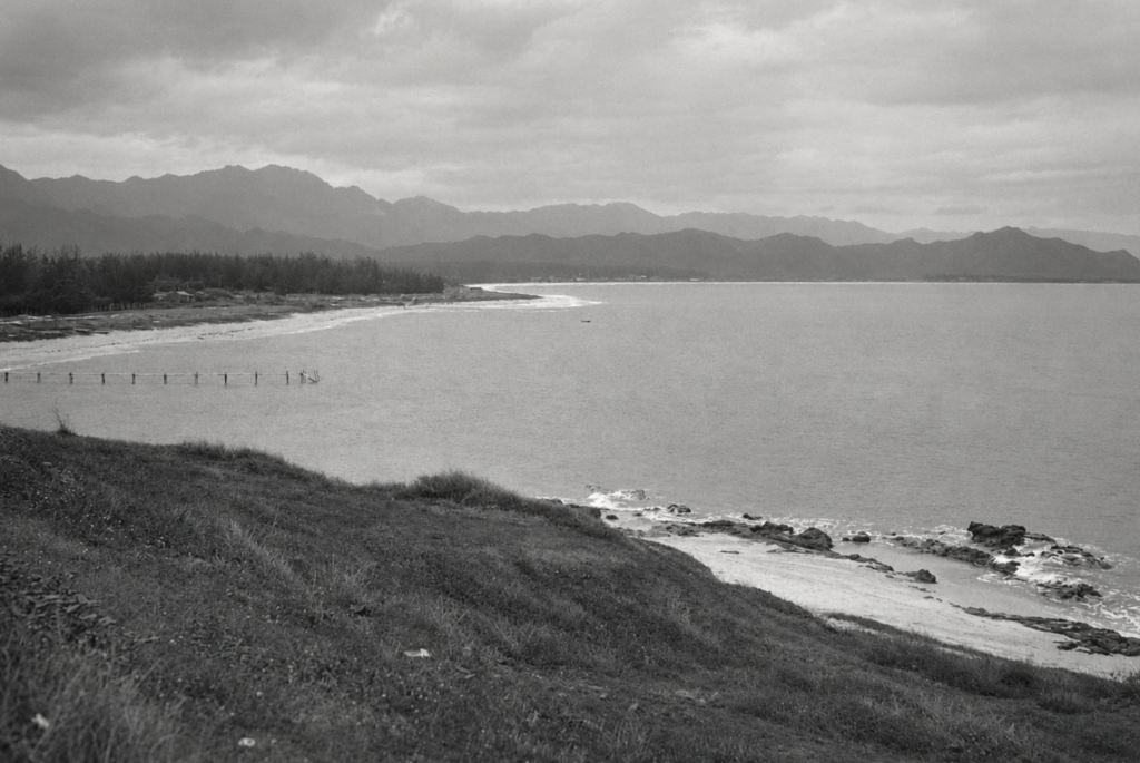
Before Kailua Beach became known mainly for swimming, paddling, and recreation, parts of the shoreline served a practical transportation role. Historical documentation records an early pier or landing along the Kailua Beach shoreline that was used to move materials into and out of Kailua. Vintage photographs show pilings extending into the bay when the surrounding beach remained largely undeveloped. The pier reflects a period when coastal transportation still mattered because reaching Windward Oʻahu overland was much more difficult than it is today.
THE OLD KAILUA PIER
By the 1920s, a pier or landing was established along Kailua Beach. The structure appears in historical photographs from a time when relatively few homes lined the shoreline. Its exact construction date and operator require further research, but archaeological and historical records confirm it transported materials. Even after the pier itself ceased functioning, remnants of the structure remained visible for decades.
Long before Kailua Beach Park became a center for swimming, paddling, and boating, an early pier or landing extended into the bay from a shoreline that was still largely undeveloped. Historical records indicate the pier was used to move materials into and out of Kailua when transportation over the Koʻolau Range remained difficult. Remnants of the structure survived into the mid-20th century, while the modern Kailua Beach Park boat ramp was constructed nearby in 1962.
REMNANTS OF THE OLD KAILUA PIER
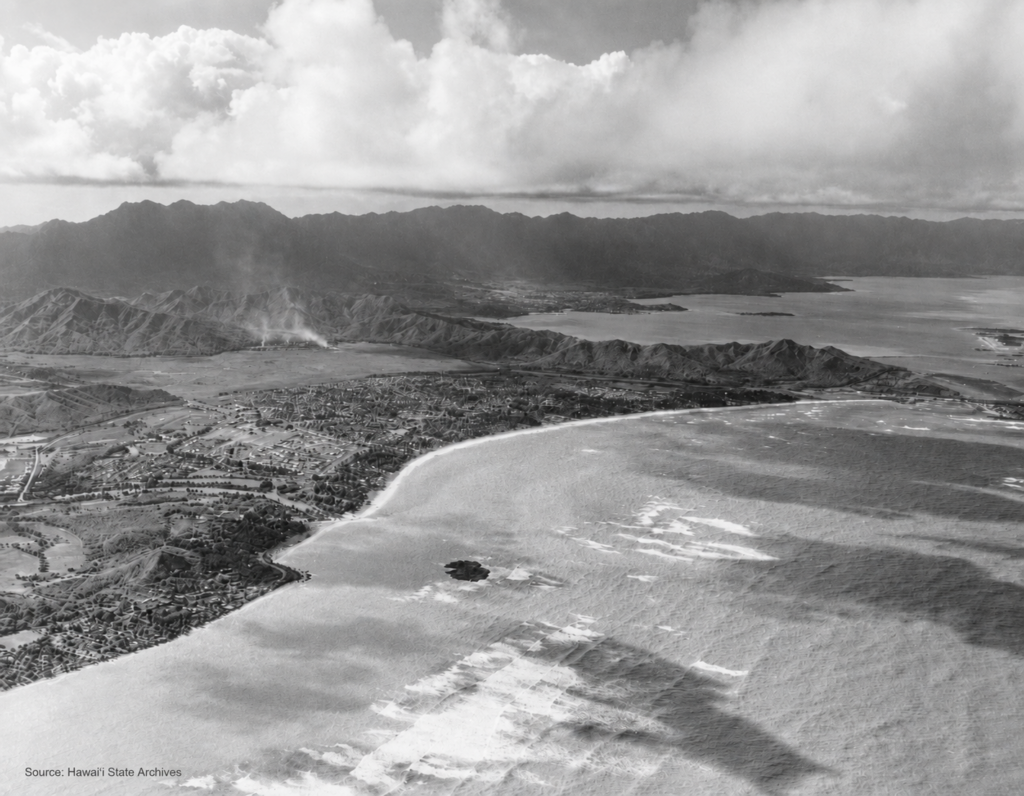
Aerial photography from the mid-20th century reportedly still showed remains of the old Kailua pier. That makes vintage photographs showing lines of pilings especially valuable. They document a transitional period when the original working waterfront was disappearing but traces of the earlier structure still survived offshore.
CAMP KAILUA
Camp Kailua became another important landmark in the beach-park area during the 20th century. The camp occupied part of the shoreline as Kailua shifted from a rural, agricultural district into a rapidly growing residential community. Mid-century aerial photographs show Camp Kailua structures along with the remains of the earlier pier. Its presence is part of the story of how the coastline evolved before the modern park took shape.
THE OLD PALI ROAD AND KAILUA’S ISOLATION
For much of Kailua’s early history, access from Honolulu was difficult. Travelers crossed the Koʻolau Range via the old Pali Road, a narrow, winding route that could be slow and hazardous. Wind, steep grades, and the limitations of early automobiles made the journey far more challenging than it is today. That difficult access helped keep Kailua and nearby Lanikai relatively isolated for years.
IMPROVED ACCESS CHANGES KAILUA
Improved roads and, later, the Pali tunnels dramatically altered Windward Oʻahu. Once travel between Honolulu and Kailua became easier, residential growth accelerated. Former agricultural lands were subdivided, new neighborhoods appeared, and Kailua increasingly became a commuter community rather than a remote coastal district. Transportation was one of the most important forces behind Kailua’s transformation.
FROM OLD PIER TO MODERN BOAT RAMP
The present Kailua Beach Park boat ramp represents a later stage in the shoreline’s maritime history.
The modern ramp was constructed in 1962, providing a formal facility for launching boats and other watercraft. The earlier pier and the later boat ramp were located in the same general Kailua Beach Park shoreline area. Their exact relationship has not been established here.
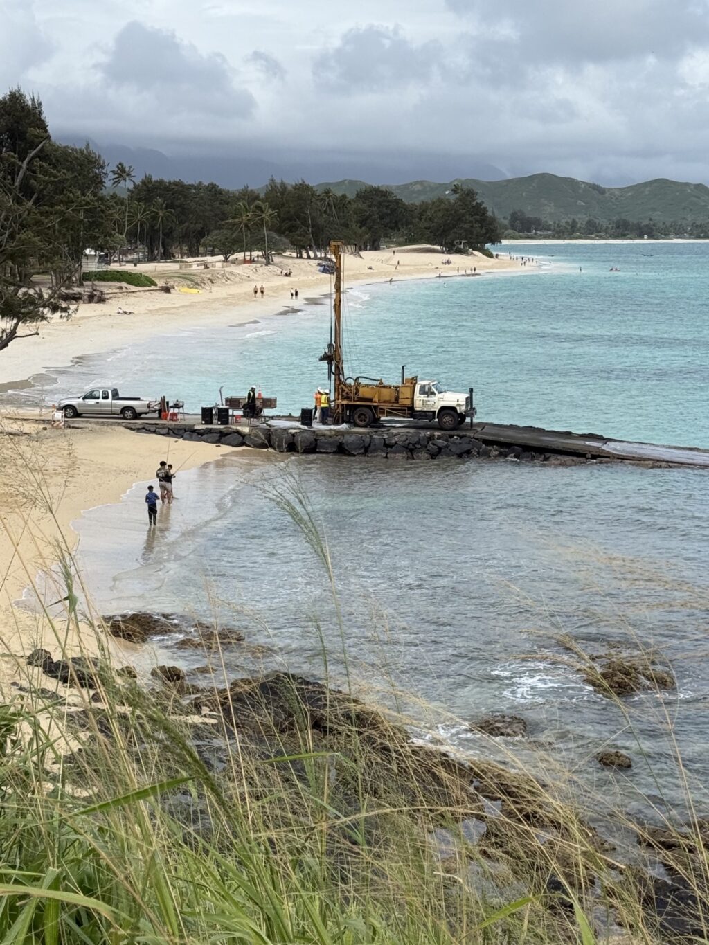
Photograph of the Kailua Beach Park boat ramp taken on March 19, 2025, during survey work associated with planned repairs to the facility. The image shows survey and drilling equipment positioned on the ramp, with Kailua Beach extending northward and the Koolau Mountains in the background. The modern boat ramp, built in 1962, marks a later chapter in this shoreline's maritime history, following the earlier pier or landing that once served the Kailua area.
Kailua Beach Park Boat Ramp, March 19, 2025. Survey work underway as part of planning for repairs to the boat-launch facility at the south end of Kailua Beach Park.
THE DEVELOPMENT OF KAILUA BEACH PARK
As Kailua’s population grew, the shoreline increasingly became a public recreational resource. Land acquisition, park improvements, removal of older structures, and new recreational facilities gradually created the Kailua Beach Park people recognize today. What had once been a lightly developed working shoreline became one of Oʻahu’s best-known public beaches.
KAILUA AFTER WORLD WAR II
The decades following World War II brought rapid change. Improved transportation, population growth, military activity, housing demand, and suburban development transformed Kailua. Agricultural fields gave way to subdivisions, new businesses opened, schools expanded, and residential neighborhoods spread across the coastal plain. The Kailua of the 1950s and 1960s was rapidly becoming a very different place from the Kailua of the 1920s.
KAILUA BEACH BECOMES A RECREATIONAL DESTINATION
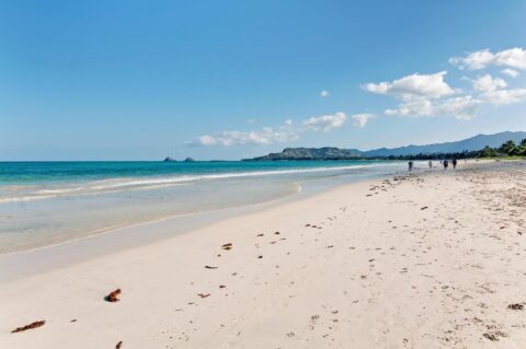
As the town developed, Kailua Beach became increasingly associated with recreation rather than commerce. Swimming, paddling, sailing, boating, windsurfing, and later kayaking and stand-up paddling became central to the beach’s identity. The coastline, once used for agriculture and transportation, became a major recreational resource for residents and visitors.
KAILUA TODAY
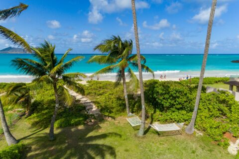
Modern Kailua bears little visual resemblance to the open coastal landscape shown in early photographs.
Yet traces of its history remain in the road layout, surviving historic properties, archaeological sites, wetlands, place names, and the shoreline itself. Understanding that history gives greater meaning to places that today may appear simply residential or recreational.